🔄 Updated 21 Jun 2026
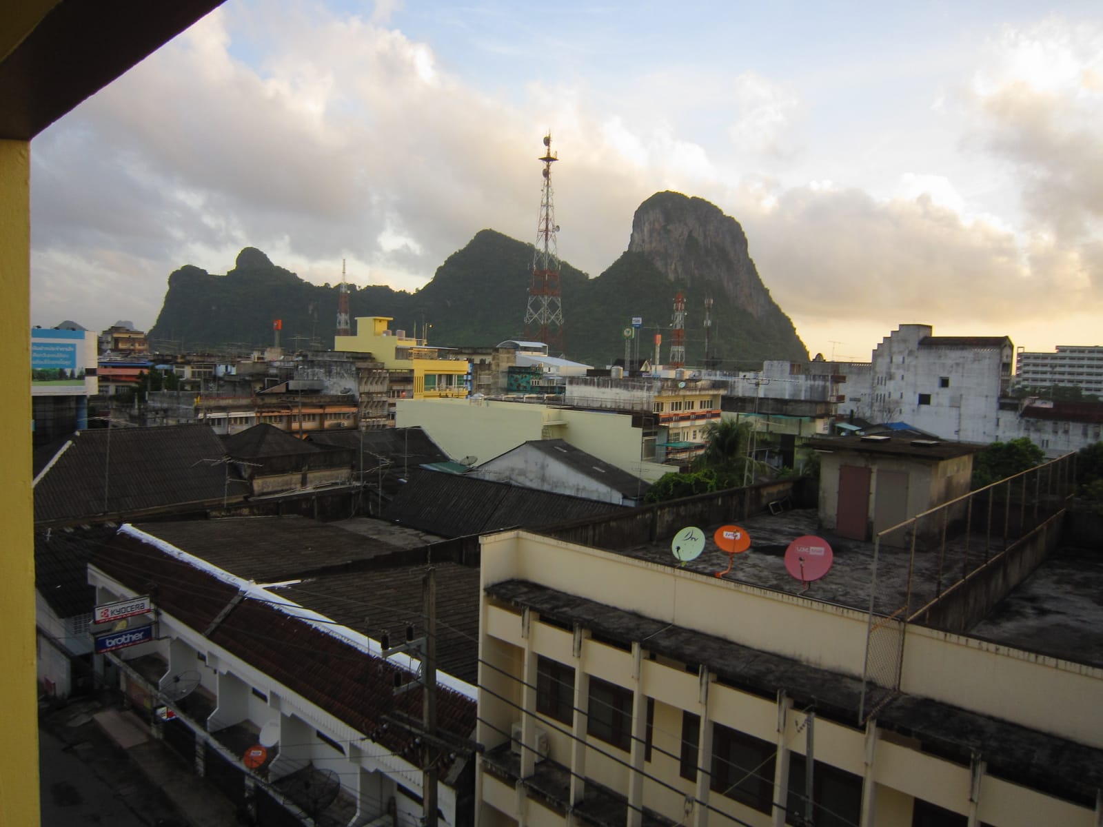
Khao Ok Thalu is a lone limestone ridge about 250 metres tall and roughly 2 km long, sitting in Kuha Sawan subdistrict, Mueang Phatthalung — just a short walk from the train station. What sets it apart from every other hill in the province is a roughly 10-metre-wide gap that punches straight through the rock near the summit. From town you can clearly see it as an open window of sky. Locals call the gap 'ok thalu' (pierced chest) and consider the hill inseparable from Phatthalung's identity — the mountain silhouette and its pagoda appear on the official provincial emblem.
Why Khao Ok Thalu Is Worth the Climb
The appeal is simple: it's a real mountain right in the middle of town. No driving out to the countryside — park at the base and start walking. Once you reach the viewpoint, the whole of Phatthalung city spreads out below your feet, with wide green rice paddies stretching into the distance, the Banthat mountain range as a backdrop, and on a clear day a thin blue line of Songkhla Lake sitting on the horizon. It's one of those spots where a single frame captures an entire province.
- The summit hole — the natural feature behind the name, clearly visible from the street, and the go-to photo backdrop
- 360-degree panorama — city, rice fields, Banthat range, and Songkhla Lake on clear days
- Ancient cave — at the base, a cave where Srivijaya-era clay votive tablets hundreds of years old were found
- Old pagoda at the top — the chedi that appears on the provincial seal, built roughly a century ago
Want more out of Phatthalung? Book tours & activities
Booking online ahead on Klook or GetYourGuide is usually cheaper than the gate and skips the queue. Pick only the experiences you actually want — prices and availability are shown live on each site.
The Stair Climb — How Hard Is It Really?
The path up is around 1,000–1,100 concrete steps. The first section is gentle, then it gets progressively steeper. People who exercise regularly reach the main viewpoint in about 30–45 minutes; if you take it slow with breaks, budget an hour. Rest stops and covered shelters are dotted along the way, and the views open up gradually as you climb — which helps you keep going.
Honest warning: if you want to reach the actual hole or the very highest point, there's an extra scramble over bare rock at the end, with ropes fixed in places. That section is for confident climbers who are comfortable with heights. For everyone else, stopping at the main viewpoint gives you the full city panorama — there's no need to push on if you're not feeling it.
Best Time to Visit
Early morning or late afternoon is significantly better than midday — the steps are open concrete with no shade, and the midday sun is genuinely brutal. Morning light also catches the rice fields at their best, while the late afternoon gives you golden-hour colours before the sun drops. If you go late, plan your descent while there's still daylight.
The Monkeys — They've Always Been Here
The base and lower section of the trail have a resident monkey troop — they've been part of Khao Ok Thalu for as long as anyone remembers. Most are not aggressive, but they're very used to people and very aware of food. Anyone carrying snacks in an open bag or swinging a plastic bag is a target. The practical answer: seal your food away, don't wave bags around, and don't feed them — feeding draws them closer and raises the chances they'll grab something out of your hand.
- Keep food zipped away — monkeys notice snack bags and water bottles fast; don't carry them openly
- Don't feed them — it makes them bolder and more likely to snatch
- Watch glasses, hats, and phones — small items are easy to grab; keep them secure
- Keep young kids close — a child holding food is an obvious target; hold their hand
The View from the Top
The viewpoint at the top is open in almost every direction. One side gives you Phatthalung city laid out below — rooftops, roads, and the train station picked out clearly. The other side sweeps across rice paddies to the Banthat mountains, and on a clear day you can pick out Songkhla Lake as a blue stripe on the horizon. It's a view that explains the whole geography of Phatthalung in one glance: a city pinched between mountains on one side and a lake on the other.
At the summit there's a Buddha image for those who want to pay respects, and the old pagoda that's been the provincial symbol for generations. People come up for a mix of reasons — sightseeing, exercise, and a quick prayer all at once. On weekends you'll find a steady trickle of locals walking up for fitness, so it never feels remote or eerie.
Getting There and Practical Info
- Location — Kuha Sawan subdistrict, Mueang Phatthalung; central town, close to Phatthalung train station
- Admission — Free. No entry fee. There's a car park at the base.
- Getting there — Easy to reach by car or motorcycle taxi from anywhere in town; a few minutes' walk from the train station
- Best time — Early morning or late afternoon; avoid the midday heat on the exposed concrete steps
What to Bring
Wear trainers with good grip. Bring your own water — there are no shops on the mountain. A hat or small umbrella cuts the sun significantly. Save some energy for the descent too: steep steps going down are harder on the knees than going up. If your knees aren't great or you're not comfortable with heights, go slowly and use the handrails.
Where to Go After Khao Ok Thalu
Because Khao Ok Thalu is right in the city, it fits easily into a full day without a car shuttle. Come down, grab breakfast or Southern Thai food in town, then head out to the nature spots nearby.
Thale Noi
Red-lotus lake and water buffalo; take a morning boat ride to see the birds. About 30 km from town.
WaterfrontLampam Beach
A lakeside waterfront where Phatthalung locals come for seafood and a breeze. Close to town.
FoodPhatthalung Southern Food
Gaeng tai pla, khanom jeen, and khao yam — proper Southern Thai bold flavour, right in the city.
Plan a full Phatthalung trip — mountain, lake, and Southern food all in one.
See the Phatthalung Travel Guide →