🔄 Updated 21 Jun 2026
The backbone of this plan is Highway 1256, which cuts from Pua district up over the mountains through Doi Phu Kha National Park, then drops down to Bo Kluea district. This stretch is only about 50 kilometres, but it's all curves climbing and descending the hills — figure roughly an hour and a half to two hours of actual driving if you don't stop. The fun is in stopping along the way, so we've spread the stops out to fit nicely across three days.
Before you set off
Route 1256 is a mountain road with lots of curves and a few steep sections, so check your brakes and tyres before you go. Fill up the tank in Pua — there are almost no large petrol stations up in the hills — and phone signal drops out in patches, so downloading offline maps will give you peace of mind.
Day 1 — Start in Pua, hit the paddy-side cafes before the climb
Pua · paddy-field cafes & a hilltop temple
Day one is meant to be easy — no need to rush up the mountain. Sleeping in Pua the first night lets you make a relaxed early start on day two, and you get the Pua-side cafes done first, because once you climb over toward Bo Kluea the spots get much further apart.
Book the activities in your Nan trip ahead
Booking online ahead on Klook or GetYourGuide is usually cheaper than the gate and skips the queue. Pick only the experiences you actually want — prices and availability are shown live on each site.
Day 2 — Drive the 1256 up Doi Phu Kha, down to Bo Kluea
Pua → Doi Phu Kha → Bo Kluea → Sapan
About timing on the mountain
Don't plan on driving the 1256 after dark — the road has no lights, plenty of curves, and the fog rolls in fast. Try to reach Sapan before nightfall (around 17:30–18:00); it's far safer that way.
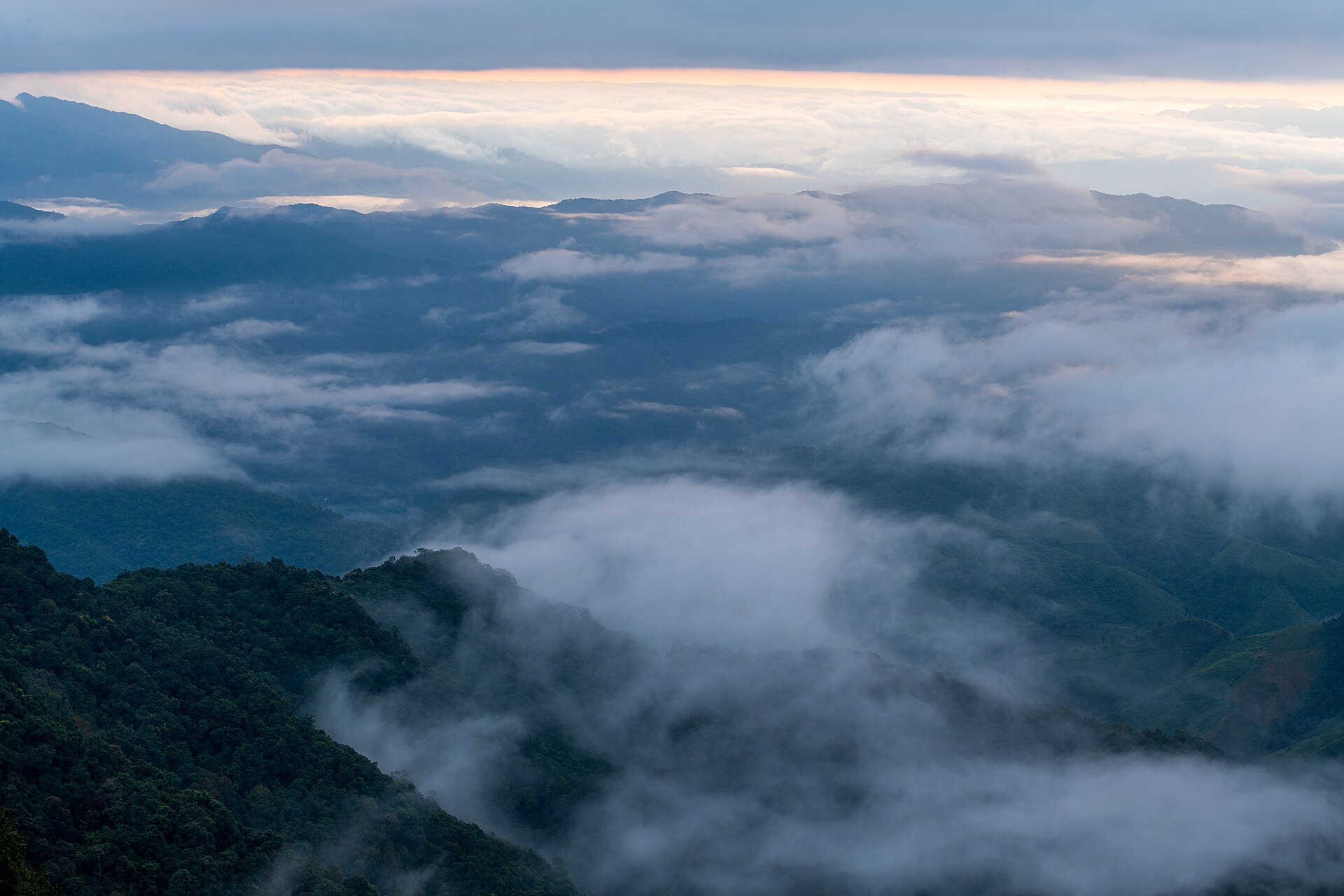
Day 3 — Catch the Sapan fog, then head back slowly
Sapan · waterfall, the curves, then loop back
When is the best time for this route
- Late rainy / early winter (Oct–Nov) — the rice is a deep green, the morning fog is thick, and the views are the best of the year. But it's crowded and stays fill up fast, so book ahead.
- Winter (Dec–Jan) — cool air, lovely fog, clear skies, great for photos. But the nights get genuinely cold, so pack something warm.
- Rainy season (Jun–Sep) — lush and green with the waterfalls running strong, but the curving road gets slippery and there's a chance of landslides. Drive carefully and check road conditions before you go.
- Hot season (Mar–May) — fewer people and cheaper stays, but some stretches get haze from crop burning, so the views may not be as clear as in winter.
Where to stay around Bo Kluea–Sapan
Sapan zone, along the Wa River
Wooden stays in the valley where you wake up to fog and rice fields — perfect for the second night of the trip. Options run from homestays to resorts with lovely views.
Bo Kluea town centre
Close to the restaurants and the salt wells, easy for finding food — good for anyone who doesn't want to drive far in the evening.
Rough budget per person (4 to a car)
- Fuel + tolls — around 500–800 THB/person, depending on where you start.
- 2 nights' lodging — around 800–2,000 THB/person, depending on the level of stay and the season.
- Food for 3 days — around 600–1,000 THB/person; local spots are inexpensive.
- Park entry + odds and ends — around 100–300 THB/person.
Straight talk
Route 1256 really is beautiful, but it's not for people who get carsick easily or for first-timers who aren't used to mountain roads. If you're not confident on the curves, hiring a car with a local driver from Nan town is the more comfortable option — and you get to take in the views without your eyes on the road.
Keep planning your Nan trip — food, places to stay, and things to do in town.
See the Nan travel guide →