🔄 Updated 21 Jun 2026
If you've ever seen a photo of a road running like a thin line along a ridge with white fog piled up on both sides, that's Route 1256, Pua–Bo Kluea. The road leaves Pua district, climbs into Doi Phu Kha National Park, passes the park headquarters around kilometer 25, then drops down toward Bo Kluea district on the eastern side, roughly 47 kilometers total. The surface is asphalt in good condition, but it's steep with curves one after another, which makes it both a beautiful and a challenging drive at the same time.
The most popular time to drive it is from the rainy season into early winter, when the hills are at their greenest and you have the best odds of a high sea of fog. If you'd rather avoid rain and slick pavement, late winter brings clear skies and easier driving, but you'll see far less fog.
Photo stops along the route
Route 1256 has marked viewpoint pull-offs at intervals. Never try to stop for photos on a curve or a narrow shoulder, full stop. Aim for the pull-offs they've already built before you get out of the car. Here are the spots people mention most.
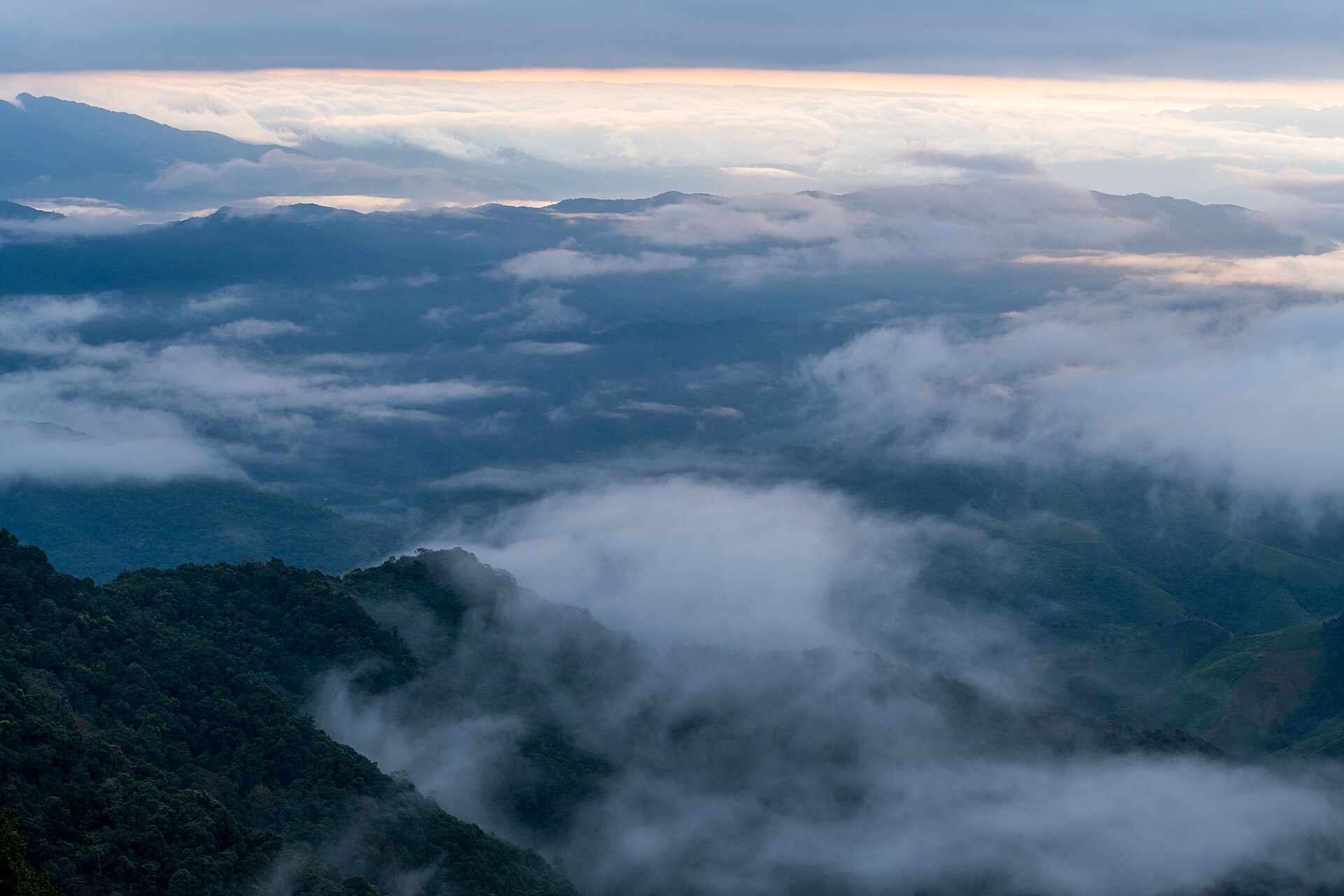
1715 Viewpoint
The highest point on the route, at around 1,715 meters. It's an open lookout with layers of mountains stretching as far as you can see, and on early mornings you've got a real shot at a valley full of fog. This is the single most popular photo stop on the road.
Stargazing Field
A wide clearing inside the park that's a viewpoint and sunset spot by day, and a tent-camping stargazing field by night. On clear nights the sky fills with stars, and there's a small cafe on site.
Doi Phu Kha 1175 Viewpoint
A lookout at around 1,175 meters, near the start of the route after the climb out of Pua. You get views of the valley and the fields below, a good place to stretch your legs before pushing on.
Doi Phu Kha Park HQ Lookout
The park headquarters area around km 25 has a lookout, restrooms, and a place to pull over. It's a good base point midway, before the long descent down toward the Bo Kluea side.
When the fog is best
The sea of fog is usually thickest in the early morning, roughly 5–7 a.m. If you want a shot of a valley packed with fog, leave your place in Pua before dawn. Once the late-morning sun comes up the fog burns off fast. The evening light at the Stargazing Field is lovely in its own way too, for anyone who can't manage the early start.
Want more out of Nan? Book tours & activities
Booking online ahead on Klook or GetYourGuide is usually cheaper than the gate and skips the queue. Pick only the experiences you actually want — prices and availability are shown live on each site.
Cafes and stops along the way
As you climb, there are cafes and pull-offs to rest your eyes every so often, mostly mountain-view spots where you can sip coffee and watch the fog. Cafes up on the mountain open and close with the weather and the season, so if you go outside the main travel months, be ready for some of them to be closed.
Mandarin Coffee, Stargazing Field
A roadside cafe on Route 1256 near the Stargazing Field, in Phu Kha subdistrict. You can sit with a coffee and take in the mountain and fog views. It's a popular midway stop.
Pua town
Your jumping-off point before the climb, with cafes set among the rice fields and several restaurants. Fill the tank, use the restroom, and grab water for the car here, because shops are scarce up the mountain.
Bo Kluea (the far end)
The eastern endpoint, home to the historic inland salt wells, with restaurants and riverside places to stay. It's a good spot to spend a night before driving back.
Entry fees and Doi Phu Kha park info
Route 1256 runs through Doi Phu Kha National Park. If you're just driving through without stopping at service areas, there's usually no entry fee. But if you stop to enjoy viewpoints inside the park or camp, there's a fee collected at the checkpoint. The current standard rate is roughly 40 THB for Thai adults, 20 THB for children, and around 30 THB per car (foreigners pay more). Bring cash, since paying online is awkward up on the mountain.
- Distance — Pua to Bo Kluea is about 47 km. With photo stops factored in, the real drive runs about 2–3 hours.
- Park headquarters — around km 25 from Pua, with restrooms, parking, and an info point.
- Fuel — fill the tank in Pua. Gas stations along the mountain route are very few.
- Phone signal — drops out on parts of the mountain, so download an offline map beforehand.
Driving the ridge road safely
Route 1256 is beautiful, but it climbs and drops steeply with hundreds of curves back to back, including some hairpins and long descents. If you're not used to mountain roads, drive slowly and don't rush. Let faster cars pass when it's safe to do so.
- Use a low gear going downhill — don't ride the brakes for long stretches, or they'll overheat and stop gripping. Let the engine help slow you with a low gear (use L or 2 in an automatic).
- Keep left into curves — on mountain bends you often can't see oncoming traffic. Tap the horn before blind curves and don't cross into the other lane.
- Check brakes and tires before you set off — especially with a rental. Test the brakes early on to make sure they grip well before the real climb.
- Avoid driving at night and in heavy rain — visibility is bad, the fog rolls in thick, and the road gets slick. Drive during daylight if you can.
- Stop for photos only at the pull-offs — never on a curve or a narrow shoulder, and switch on your hazard lights every time you stop.
What kind of car you need
A regular sedan handles this road just fine thanks to the good surface, as long as the engine has enough power to climb and the brakes are in good shape. If you're a new driver or get carsick easily, let whoever is comfortable on these roads do the driving, leave plenty of extra time, and don't force it when you're tired.
Plan the rest of your Nan trip
See the Nan travel guide →