🔄 Updated 21 Jun 2026
The two main roads of this loop are Highway 1095 (Chiang Mai–Pai–Pang Mapha–Mae Hong Son) and Highway 108 (Mae Hong Son–Mae Sariang–Hot–Chiang Mai). Both are paved the whole way and an ordinary sedan handles them fine, but the bends are constant and genuinely steep — especially the Chiang Mai-to-Pai stretch, which is counted at 762 curves. Anyone in the passenger seat who gets carsick easily should take something for it beforehand. We suggest driving counter-clockwise — Pai first — because the nastiest curves come on day one while your body is still fresh, leaving the wider, gentler Highway 108 for the final day home.
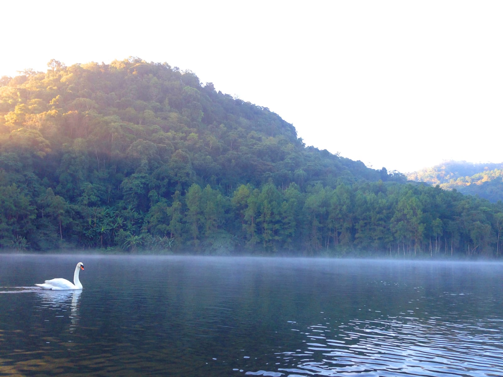
One thing to be honest about before you plan: the sea of fog and the mountain views along this whole route depend entirely on the weather on the day. Some mornings the fog rolls in thick and beautiful; other mornings it's clear with no fog at all. The fog shows up most often and the views are crispest from November through February. March and April are the burning season in the north, when haze usually blankets the views and makes breathing harder — if you're sensitive to dust or have respiratory issues, avoid this window.
Before you set off
Fill the tank in Chiang Mai and top up every time you pass through Pai and Mae Hong Son, because petrol stations are far apart along the Pai–Pang Mapha–Mae Hong Son stretch. Check your tyre pressure and brakes properly. If you rent a motorbike in Pai, photograph its condition before you take it every single time. And carry plenty of small cash — most viewpoints, raft fees, and little shops take cash only.
The 4-day, 3-night loop at a glance
- Day 1 — Chiang Mai up to Pai, with a stop at Huai Nam Dang on the way; reach Pai mid-afternoon, see the Big Buddha at dusk, then hit the walking street
- Day 2 — Catch the Yun Lai fog over Pai at sunrise, then drive to Mae Hong Son with a stop at Lod Cave; climb Wat Phra That Doi Kong Mu in the evening
- Day 3 — A full nature day: pre-dawn raft ride through the fog at Pang Ung, then Yunnanese tea at Ban Rak Thai, back to sleep in Mae Hong Son
- Day 4 — Loop back to Chiang Mai via Mae Sariang; Highway 108 is wider with fewer curves, an easier way to close the trip
Book the activities in your Pai trip ahead
Booking online ahead on Klook or GetYourGuide is usually cheaper than the gate and skips the queue. Pick only the experiences you actually want — prices and availability are shown live on each site.
Day 1 — Chiang Mai up to Pai, via Huai Nam Dang
Day one has the most curves of the whole loop. It's only about 135 kilometres, but it takes a real 3–4 hours of driving because you're inching around the bends. Leave a little early so you can hit Huai Nam Dang before the morning fog burns off.
Chiang Mai → Huai Nam Dang → Pai (~135 km)
If you get carsick
The Chiang Mai–Pai stretch is curve after curve with barely a break. If you're prone to motion sickness, take something 30 minutes before you leave, sit up front if you can, look far down the road, sip water steadily, and avoid your phone along the way. The Chiang Mai–Pai minivans make one mid-route stop to let everyone stretch.
Day 2 — Pai to Mae Hong Son, via Lod Cave
Day two runs about 110 kilometres and is still curvy mountain road. Catch the Pai fog in the morning first, then drift down toward Mae Hong Son. If you get an early start you can fit in Lod Cave at Pang Mapha — a roadside highlight a lot of people skip because they're rushing.
Pai → Lod Cave → Mae Hong Son (~110 km)
Day 3 — Pang Ung and Ban Rak Thai, a full nature day
No long drive today. Use Mae Hong Son as your base and swing out to Mok Champae sub-district north of town to pick up Pang Ung and Ban Rak Thai, which sit on the same road — the nature highlight of the entire loop. Pang Ung is about 15 kilometres from town along Highway 1095 on the Mok Champae side; the last part of the road is narrow and winding, so drive carefully.
Mae Hong Son → Pang Ung → Ban Rak Thai (round trip ~80 km)
Mexican sunflower fields
If you come from mid-November to early December, stop at the Mexican sunflower fields at Doi Mae U Kho (Khun Yuam district) on the final-day drive back. The yellow blooms cover the whole mountain — it's the peak season for Mae Hong Son in the entire year.
Day 4 — Loop back to Chiang Mai via Mae Sariang
The final day is the longest drive — about 270 kilometres, heading south on Highway 108 through Khun Yuam–Mae Sariang, then back up to Chiang Mai. Highway 108 is much wider with far fewer curves than the Pai side, so the driving is a lot easier — a good way to close the trip when your body is starting to tire from the first three days.
Mae Hong Son → Mae Sariang → Chiang Mai (~270 km)
Entry fees and a rough budget
- Huai Nam Dang park entry for Thais around 40 THB · Yun Lai 20 THB
- Lod Cave guide + raft around 150–450 THB per group depending on group size and chambers
- Pang Ung adult entry around 20 THB + raft around 150 THB for two people
- Big Buddha at Wat Phra That Mae Yen · Wat Phra That Doi Kong Mu · Nong Jong Kham · Su Tong Pae Bridge free entry
- Car rental in Chiang Mai around 800–1,500 THB/day, or motorbike rental around 150–300 THB/day, plus a fair amount for fuel over the whole loop
Prices are estimates
Entry fees, raft fees, and rental rates can rise depending on the season and whoever's running each spot. Keep small cash on you, because many sites and little shops along the route take cash only, and ATMs outside the towns are hard to find.
Three days or five days — which is better?
The 4-day, 3-night plan above is the sweet spot for most people — you get to actually see things without driving yourself into the ground. But if you're short on time or have extra to spare, here's how to adjust.
3 days, 2 nights
Cut the nature day at Pang Ung–Ban Rak Thai: one night in Pai, one night in Mae Hong Son, then loop back. Good if you're short on time, but it'll feel like more driving than sightseeing.
4 days, 3 nights
The plan we recommend — Pai, Lod Cave, Mae Hong Son, Pang Ung, Ban Rak Thai, and Highway 108 home. The pacing is just right.
5 days, 4 nights
Add another night in Pai for a full day of cafés and waterfalls, or stay over in Ban Rak Thai for a night without rushing, to catch the village in the early morning.
Getting ready for this loop
- Best season — November to February: cool air, thick fog, sunflowers in bloom. Avoid March–April, when wildfire haze hangs heavy over the whole north and affects both the views and your breathing
- Vehicle — a sedan handles it easily, paved the whole way on the main roads; but if you're on a motorbike you should have mountain-riding experience, wear a full-face helmet, and avoid riding at night since there's little street lighting
- Accommodation — book ahead in the cool season and on long weekends; Pai and Ban Rak Thai fill up fast
- Cash — carry plenty; small shops, viewpoints, and raft fees mostly take cash, and ATMs outside the towns are hard to find
- Warm clothes — mornings and evenings in the hills are genuinely cold, especially Pang Ung and Yun Lai in the cool season, with some mornings below 10°C
Want a well-placed stay in Pai to base your loop from?
See 10 recommended Pai stays →